
July 16th, 2026
August 1, 2026 - Always double-check with official channels like BC Wildfire and BC Highways before travelling to another town during wildfire season.
If you're considering a trip to Pemberton, you may be wondering whether it's safe to visit following the recent Signal Hill wildfire. The short answer is yes - Pemberton is open to visitors, and local businesses are operating and ready to welcome you. However, wildfire season is a constantly changing environment in British Columbia, so it’s always important to stay informed, know where to find official information, and be prepared before you travel.
I heard there was a fire in Pemberton - is it safe to visit?
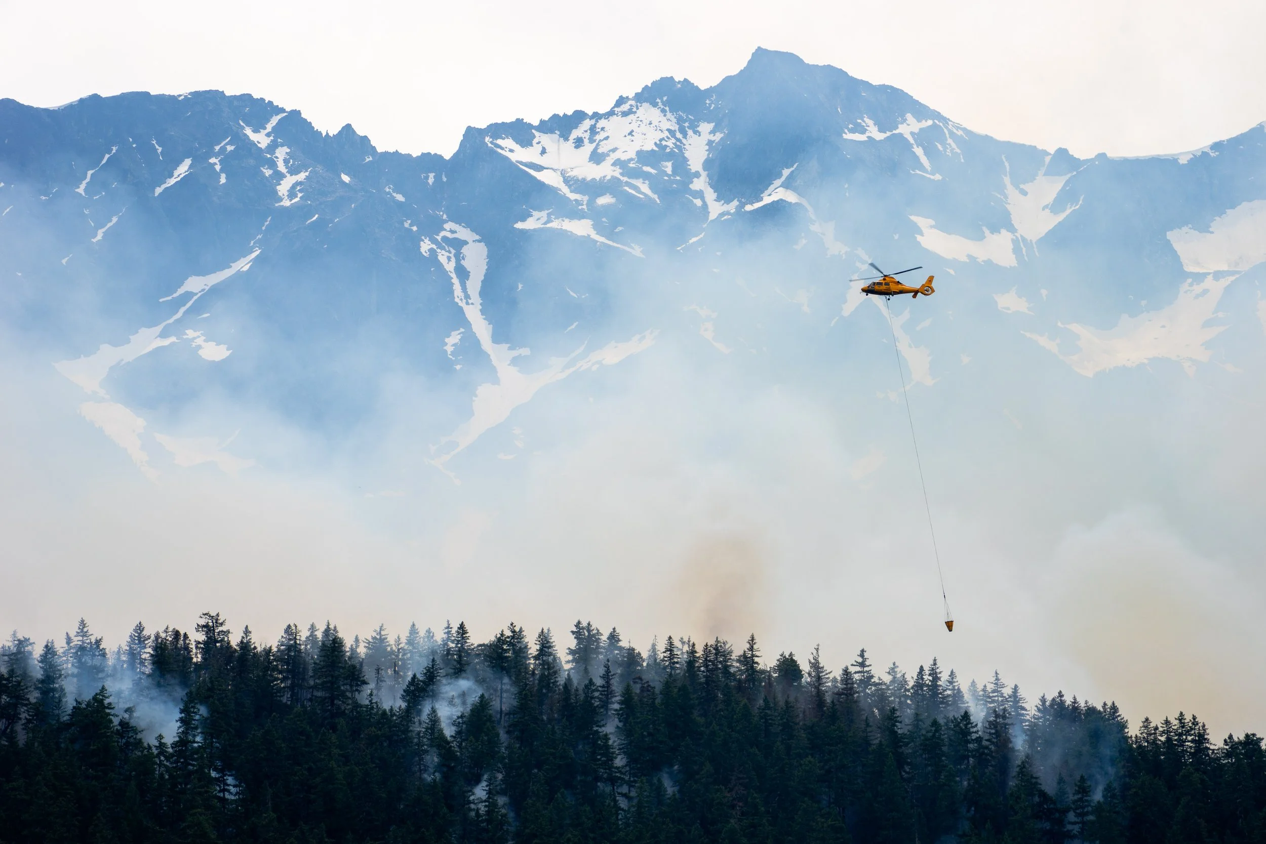
Yes, Pemberton is open to visitors. A fire on Signal Hill (above One Mile Lake) was reported on July 15th, 2026. BC Wildfire responded very quickly with ground and air attack, and we are happy to report that the fire is now reported as Under Control. All Evacuation Alerts and Orders have been rescinded.
Currently, there is a fire along Lillooet Lake with an Evacuation Order in place for Twin Two Creek. The Lillooet Lake Recreation Sites, including the popular Strawberry Point Campsite, are closed. The In-Shuck-Ch Forest Service Rd along Lillooet Lake is reserved for local traffic only and should be avoided to keep the area clear for responders and local traffic who may need to evacuate.
Lillooet Lake should not be visited at this time. Please keep the area clear.
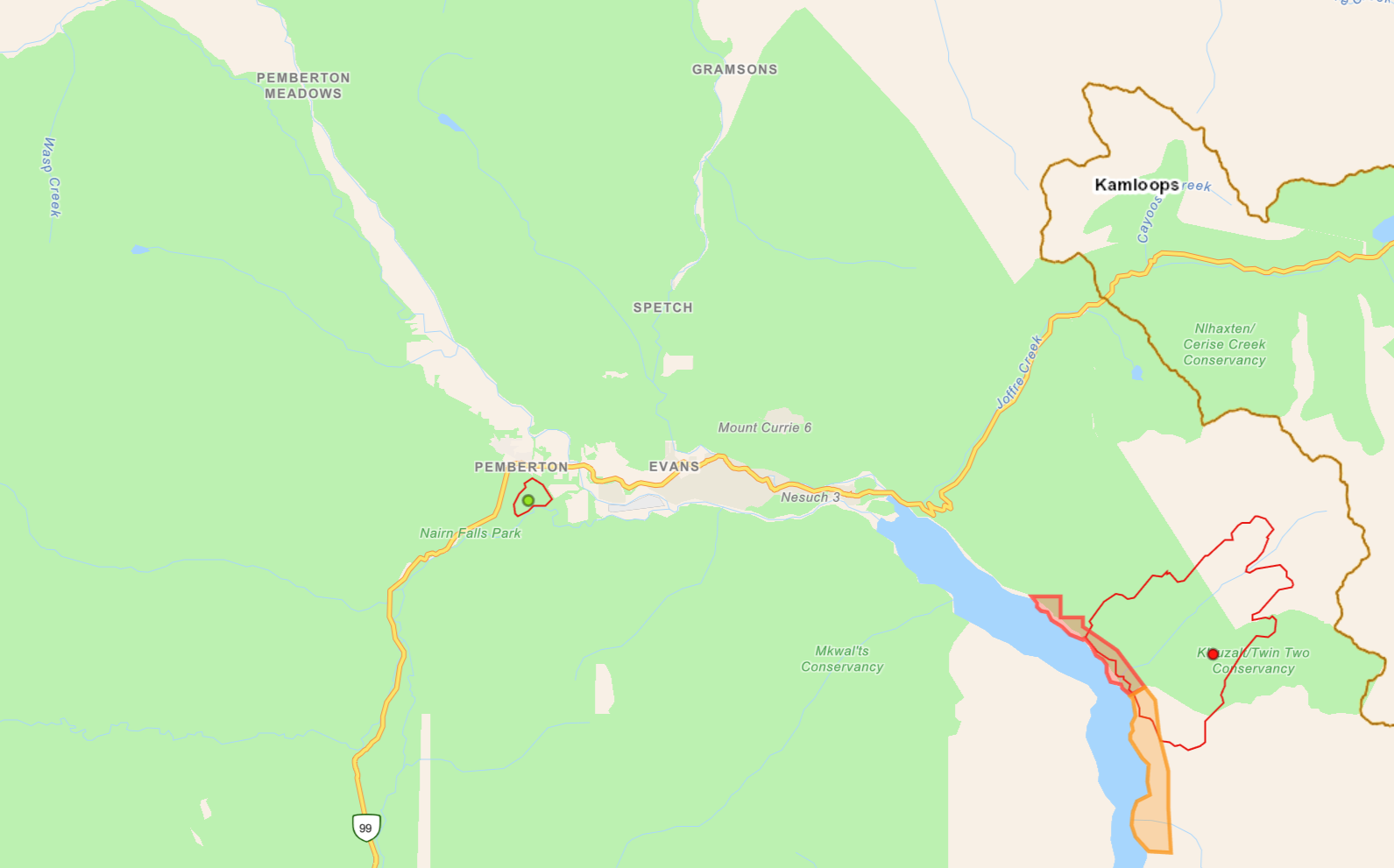
BC Wildfire: Aug 2, 2026
Is One Mile Lake Park open?
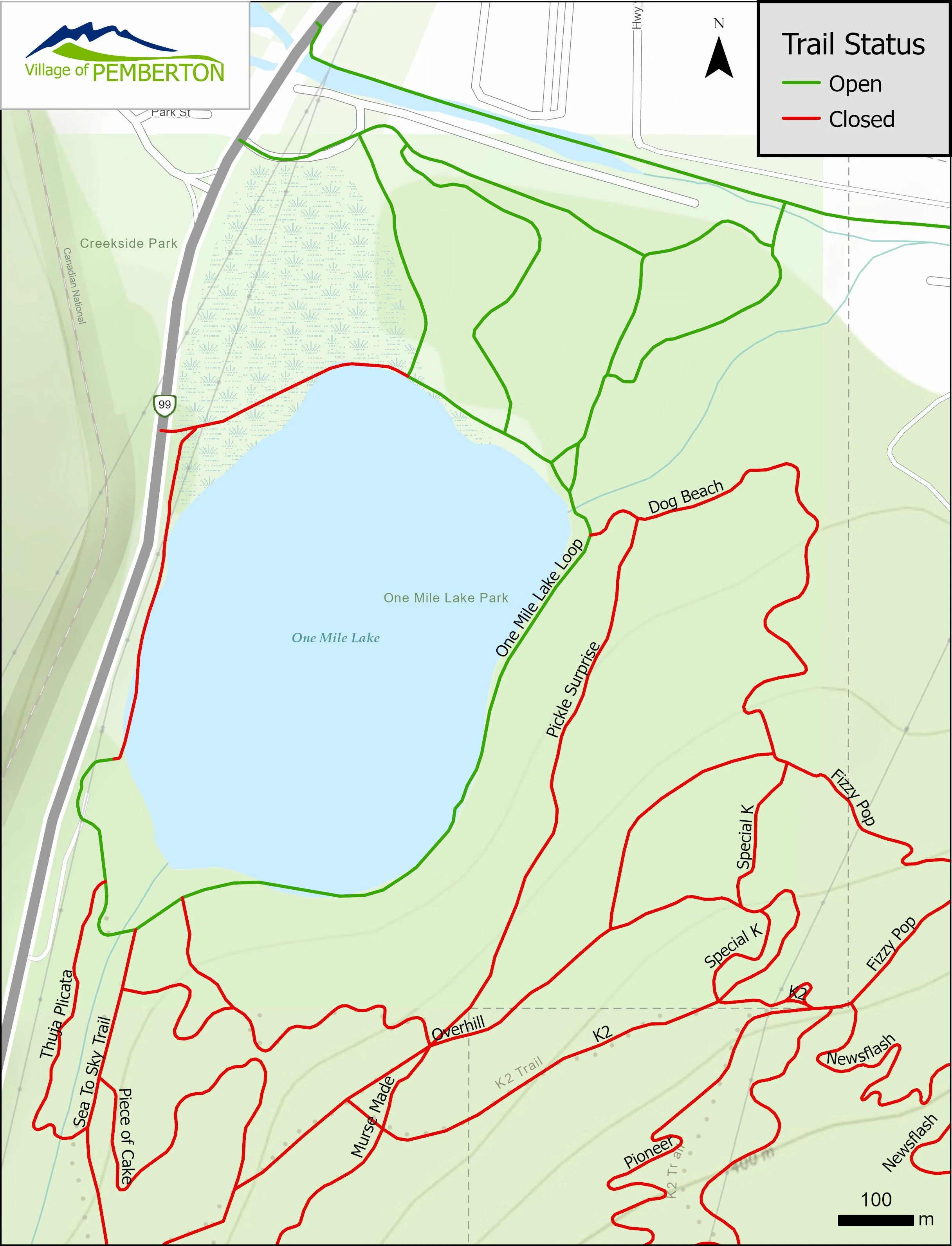
BC Wildfire have rescinded the Evacuation Order for One Mile Lake Park following closure due to the proximity of the fire and to allow safe access for the crew. Portions of the Park have now been reopened to the public, including:
Main parking lot and beach area
One Mile Lake Park Loop Trail
Dog beach area
Access trails connecting to Underhill Park
The wildfire burned through the extensive trail network on Signal Hill above One Mile Lake. The following areas remain closed due to dangerous burnt trees, fire-affected terrain that is now unstable, and to allow crews to safely operate in the area:
Hiking and Biking Trails on Signal Hill
Sea to Sky Trail connecting to Nairn Falls
Frisbee Golf Area
Unrelated to the wildfire, the over-water boardwalk section of the One Mile Lake Park Loop Trail is closed for repairs.
How can I stay informed about wildfires, if it’s safe to visit an area, and if the roads are open?
Always refer to official channels regarding wildfire and Highway alerts, orders and closures.
Download the BC Wildfire app, or visit the website, to have easy access to the interactive fire map where you’ll be able to see all information about wildfires in a certain area, Evacuation Alert zones, Evacuation Order zones, and additional data on provincial burns. You can also check for fire ban information related to the area you are visiting to know what restrictions are in place.
Visit Drive BC to check for any road closures, major or minor events, or future roadworks to ensure you have an open route to your destination (or to leave).
Visit BC Sites and Trails and BC Parks websites to check if your campsite/park/trail is open before heading out.
Going on an off-road adventure? Check the Forest Service Road Safety Information for any closures or notices on Forest Service Roads.
Check the Weather Radar before heading into the backcountry to check if there is potential for lightning in the area you are visiting. Did you know lightning accounts for approximately 60% of wildfire starts in BC?
How do I report a wildfire?
Submit reports of wildfire or smoke in British Columbia on the BC Wildfire Service website.
Or through the BC Wildfire Service mobile app. This process usually takes 5 to 10 minutes.
Reports can also be called into the Provincial Wildfire Reporting Centre toll-free at 1 800 663-5555 or *5555 on a cell.
There are no wildfires near me or in the town I want to visit - do I still need to check reports?
Even if a wildfire is not in your town or the town you are visiting, it’s always good to know where nearby wildfires are and if there are evacuation alerts or orders in place. If an evacuation order is made, it’s a good idea to avoid the roads leading out of that area to keep them clear for evacuees and responders. During the Summer, you may need to adjust your travel plans so that you’re not adding to potential congestion on the roads, or to keep accommodations free in neighbouring towns when evacuation orders are in place nearby.
If you have respiratory issues, you may wish to avoid travelling closer to a region where there is a fire. Even if that fire is hundreds of kilometres away, the wind direction can blow it into towns otherwise unaffected. A good resource to see if smoke may blow into the area you are visiting is the Fire Smoke Map.
Adventuring in the backcountry this Summer? Don’t Love It To Death.
Human-caused wildfires have dropped from 30% to 43% in BC. Let’s keep that trend going by:
Respecting wildfire prohibitions and campfire bans
Keeping fires to designated areas
Never discarding cigarette butts
Knowing how to report a fire
Visit Don’t Love It To Death for more ways to reduce your impact when adventuring.