Experience
Range Beyond Range Circle Route
Where roads run wild, and so can you.
To range beyond range through the peaks and valleys of the Coast, Cayoosh, and Chilcotin mountains — through the unceded ancestral territories of the Líl̓wat Nation, the St’at’imc Nation, and the Tŝilhqot’in Nation — is to follow roads less travelled into landscapes that shift you: where rivers carve the steeps, stars flood the night sky, and silence stretches for miles.
The Range Beyond Range Circle Route connects the mountain towns of Pemberton, Lillooet, and the Bridge River Valley in a 284 km circuit that blends paved highways, gravel backroads, and wild beauty. It’s mostly out of cell service and entirely out of the ordinary. Travelling in either direction, the loop carries you from glacier-fed valleys to sun-drenched canyons and into BC’s deep interior; a region shaped by fire, water, gold, grit, and story.
Whether you climb the switchbacks of Duffey Lake Road or take the Hurley Forest Service Road straight into the heart of the mountains, you’ll need a good vehicle, good tires, and an even better sense of adventure. (Bring a spare. And don’t rely on Siri, she doesn’t do backroads.)
But those who seek the road less paved will be rewarded: with wine glasses and wildflowers, with gold pans and glaciers, with pit cooks and poetry, with floatplanes and fishing lines and the sudden hush of a forest that’s been here far longer than we have.
Come range among the elements and find yourself in the wilds of British Columbia.
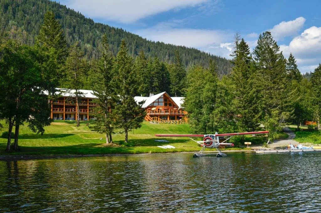
Pemberton
Just north of Whistler, Pemberton is the southern gateway to the Range Beyond Range route. A place where wide-open meadows meet towering peaks, and farm stands outnumber stoplights. Rest up at one of our Lodges or cosy B&Bs (or camp beside a river) before beginning your journey with a thrilling adventure in town. There’s something for everyone to choose from here - golfing, horse riding, jet boating, fishing, mountain biking and hiking. Before you hit the road North, stock up on delicious produce, baked goods and supplies for your journey into the rugged.
The drive north from Pemberton into the Cayoosh Range is nothing short of jaw-dropping. You’ll climb out of the valley and into one of the most scenic drives in BC. The Duffey is a stretch of road known for its winding turns, alpine lakes, and stunning views - keep an eye out for pullouts and peaceful campsites.
Pemberton → Lillooet (via Duffey Lake Road / Hwy 99)
Distance: ~100 km | Drive Time: 2–2.5 hours | Road: Paved but steep, winding, and out of cell service
Tips:
Fuel up in Pemberton. There are no gas stations until Lillooet.
Take breaks at scenic pullouts: Duffey Lake, and Seton Lake viewpoint.
Be prepared for steep grades and sharp turns. Use low gear on descents and brake wisely.
Cell service is spotty to non-existent, so download offline maps.
Stock up on supplies and delicious produce in Pemberton before setting off


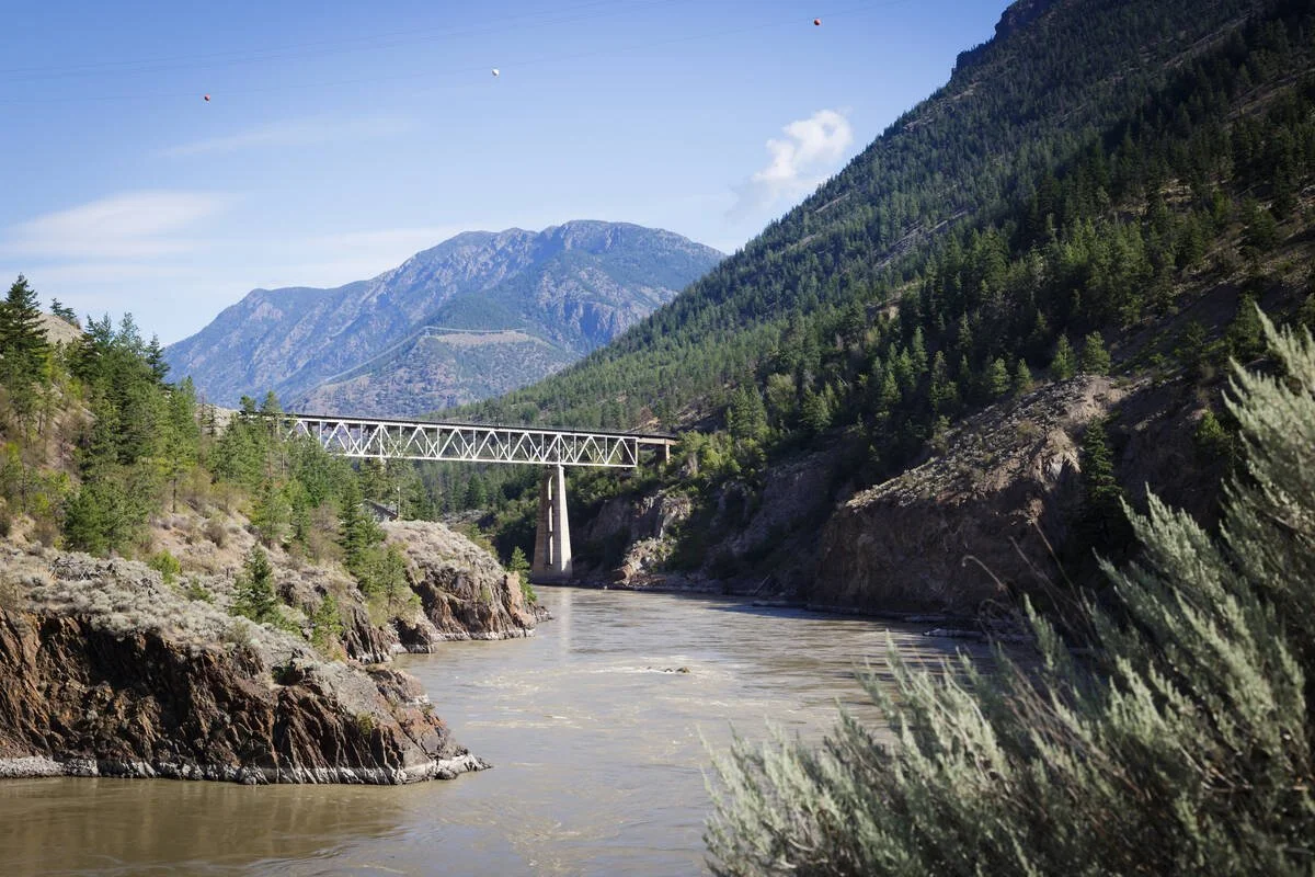
Lillooet
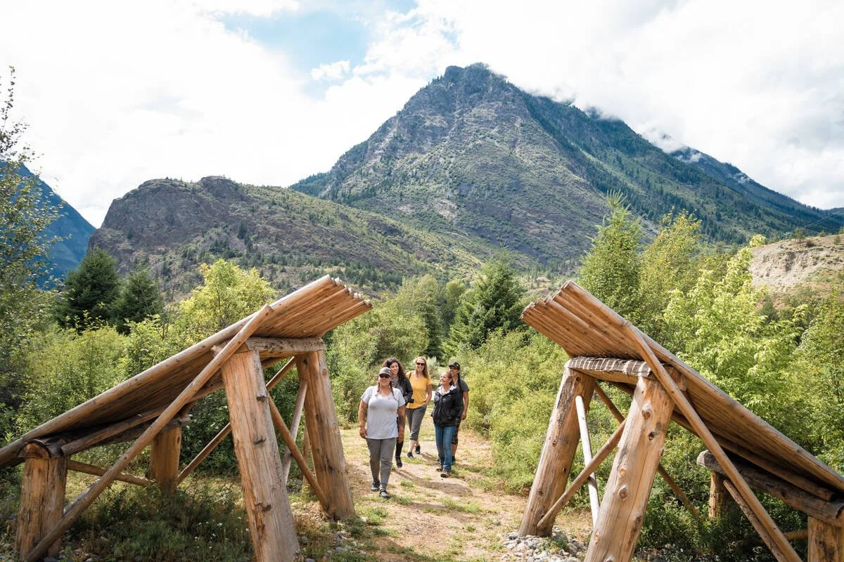
Tucked between canyon walls and the confluence of cultures, Lillooet is a town shaped by water, gold, and time. You’ll trade the lush rainforest of Coastal BC for the arid landscape of the Interior with just one turn of a corner. Sitting at the edge of the Fraser River, Lillooet is one of the hottest and driest places in Canada, and one of the most compelling. Known historically as Mile 0 of the Cariboo Wagon Road, this community has deep Indigenous roots and a rich Gold Rush legacy.
Stop in to sample award-winning wines, explore Indigenous art galleries, walk across the Old Suspension Bridge, or visit petroglyphs and heritage sites that speak to thousands of years of history. Next, you’ll trade river valley for high country as you ascend into the Bridge River Valley, one of the province’s best-kept secrets.
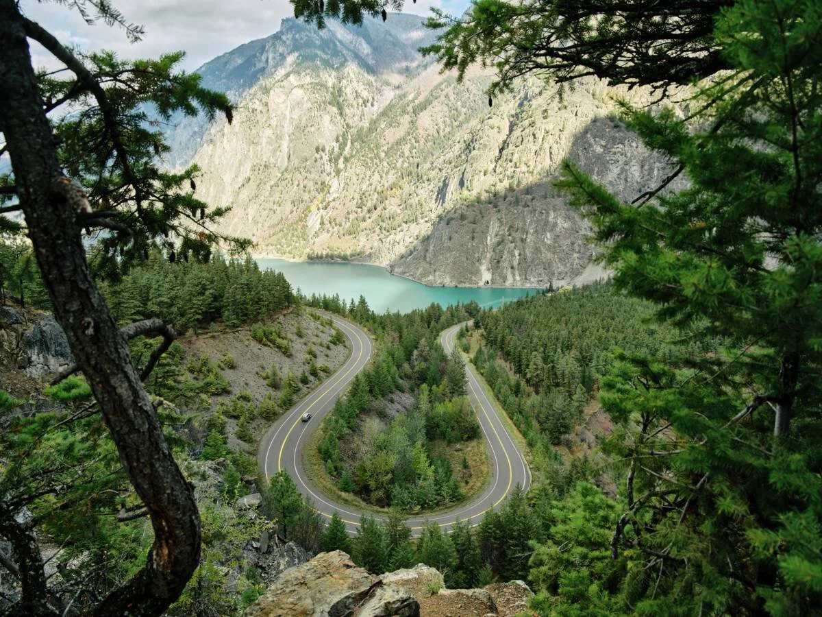
Lillooet → Bridge River Valley (via Hwy 40 / Carpenter Lake Road)
Distance: ~100 km | Drive Time: 2 hours | Road: Paved and gravel sections; narrow in places
Tips:
Top up your tank in Lillooet. There are no stores, gas, or cell service until you reach Gold Bridge.
Go slow. The road is narrow and winding with few guardrails. Watch for washouts and fallen rock.
Check DriveBC or local FB groups for current road conditions and closures, especially in spring and fall.
Stop and stretch at Horseshoe Bend, Terghazi Dam or along the lakeshore to break up the journey.
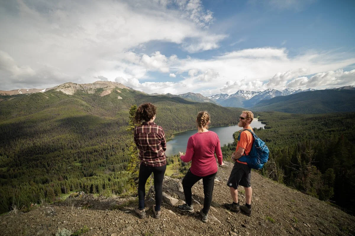
The Bridge River Valley is an off-grid sanctuary where mountain peaks, alpine lakes, and wildflower meadows stretch endlessly beneath big skies. It’s a place to trade pavement for singletrack and noise for stillness, where the South Chilcotin Mountains Provincial Park becomes your playground.
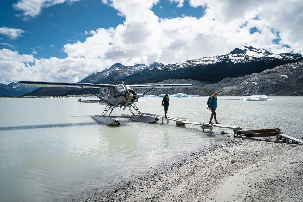
Launch into the backcountry with guided hiking or biking tours, or take to the skies on a floatplane to icebergs and glaciers. Find rest at Tyaughton Lake, where loons break the silence. Stop in at Gold Bridge for supplies and stories from the locals, or continue on to Bralorne, a former gold mining town turned laid-back basecamp for mountain adventures. Whether you’re summiting ridgelines, casting lines, or soaking in the silence, the Bridge River Valley is where your wild side gets to roam.
Bridge River Valley
Bridge River Valley → Pemberton (via Hurley Forest Service Road)
Distance: ~85 km | Drive Time: 2 hours (depending on conditions) | Road: Gravel, 4x4 recommended
Only attempt the Hurley in summer and early fall. The Hurley is closed in winter conditions.
Check isurvivedthehurley.com before setting out — it’s the most up-to-date source on road status.
Bring a full-size spare tire, and know how to use it. The road is notorious for sharp rocks and flat tires.
No cell signal until you're back in Pemberton — travel with water, food, and emergency supplies.